


Introduction
Belgium has a very classic gameplay, the main information are municipalities and road numbers. Two information may help you find your municipality on the map : spoken language and phone number.
Street signs
In belgium, you often find the municipality name on street signs.
Languages
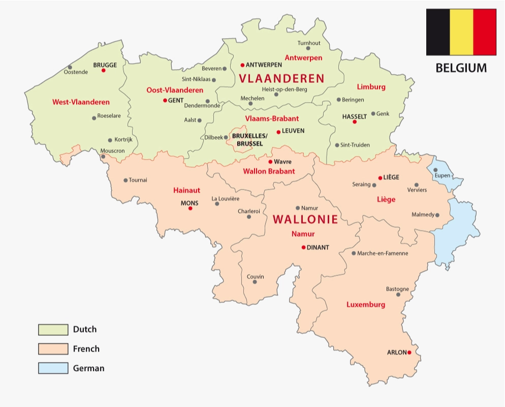
There are five linguistic areas in Belgium : flemmish in the north, french in the south, bilingual in Brussels, and 2 small german speaking areas in the east.
Highways E, A and B
Belgian highways have 2 names, one that starts with E (european numbering system) that is easy to spot on the map, and one that starts with A then 1 or 2 digits, which require zooming to be seen. If you find the "Ax" name, you will need to scan the E roads with a good enough zoom.
Highways A with single digit start from Brussels.
Highways A with 3 digits and highways B are small portions linking other major highways.
Ring roads R
R is for Ring road. The biggest ones are R0 around Brussels, R1 and R2 around Antwerpen, R3 around Charleroi.
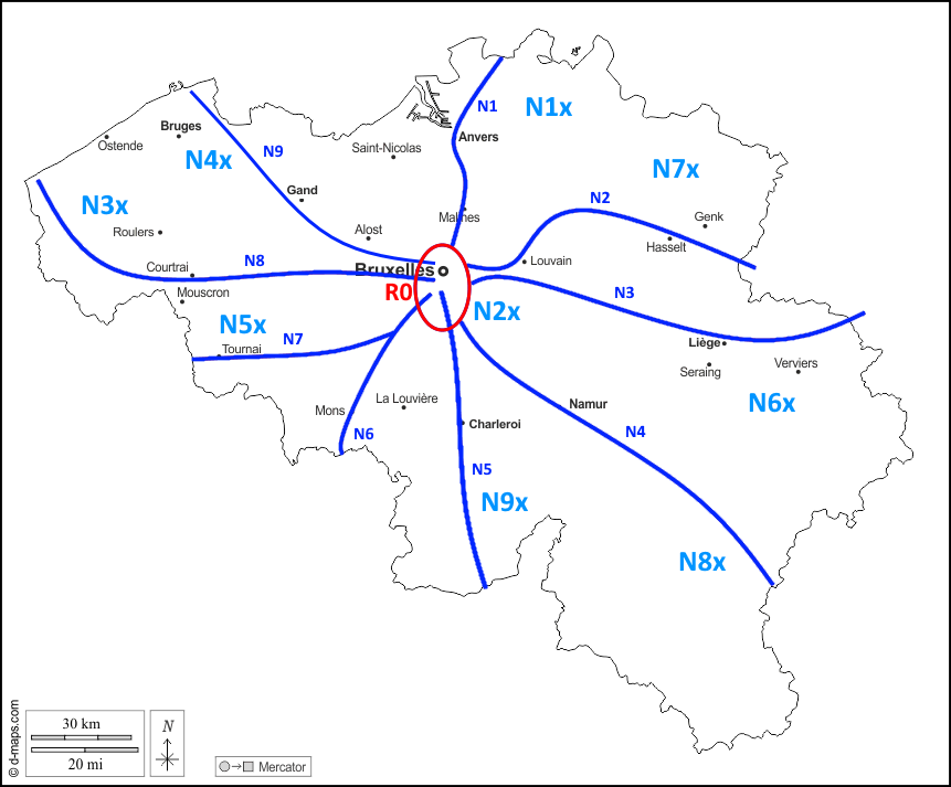
National roads N
N road follow some kind of pattern : N1 à N9 link Brussels to the main cities of the country. 2-digits and 3-digits N roads are in specific areas, but beware, there are some exceptions.
Cities
To learn the cities, there is the City Quiz.
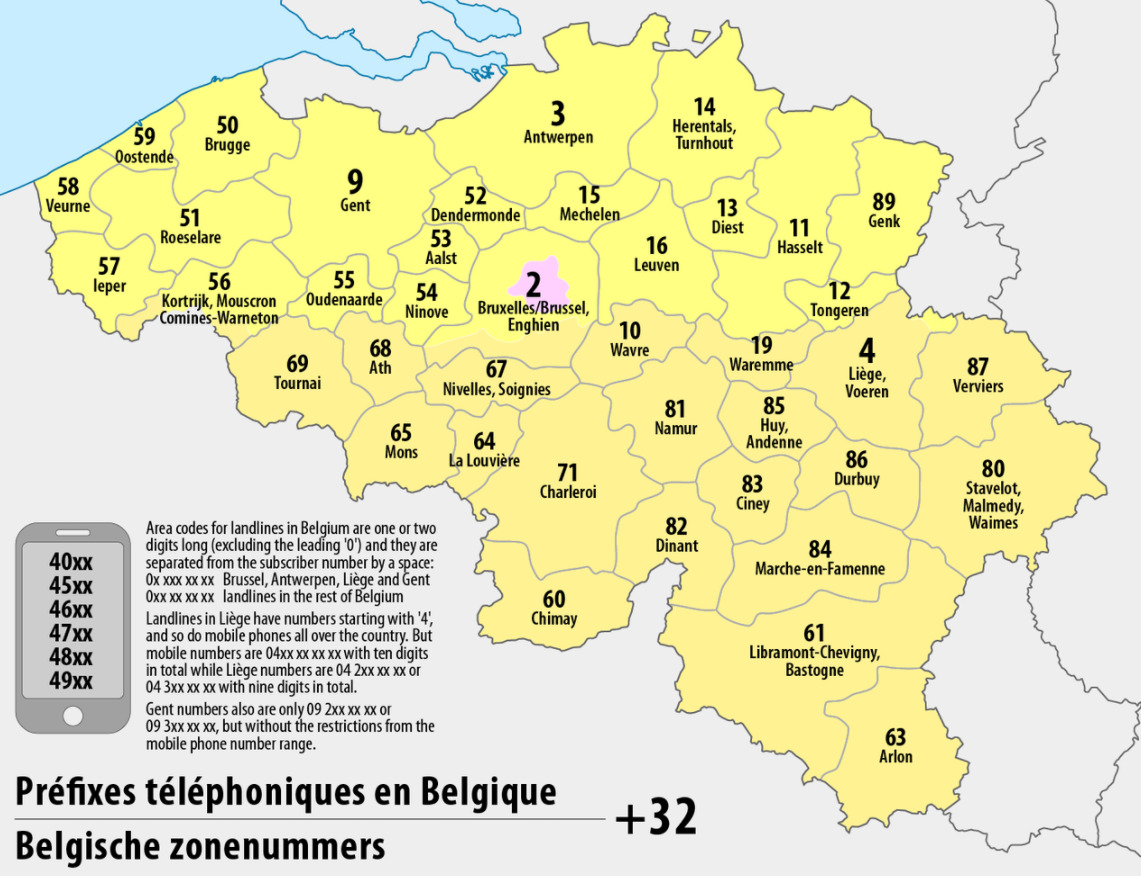
Phone numbers
Landlines are 9 digits numbers, including a 2 or 3-digit area code beginning with 0. Cell phone numbers are 10 digits numbers starting with 04, which is a little similar to Liège area, make sure to count the digits to tell the difference.
To learn the phone numbers, there is the Phone number quiz.
Regions
This Seterra quiz can help you memorize them.
Specific place
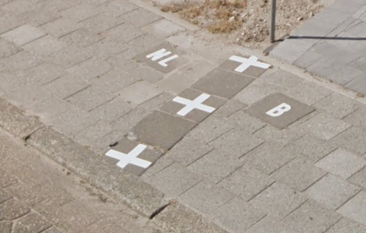
Baarle Hertog is a belgian enclave in the Netherlands, near the town of Turnhout at the border. You may find border paintings on the sidewalk.