


Introduction
Canada is divided in 10 inhabited provinces, and 3 territories relatively empty in the north.
The easy guide focuses on provinces, cities, and basic knowledge.
The intermediate guide is about recognizong the provinces thanks to the road signs.
The tryhard guide tells you about phone numbers and some very specific places.
Provinces and territories
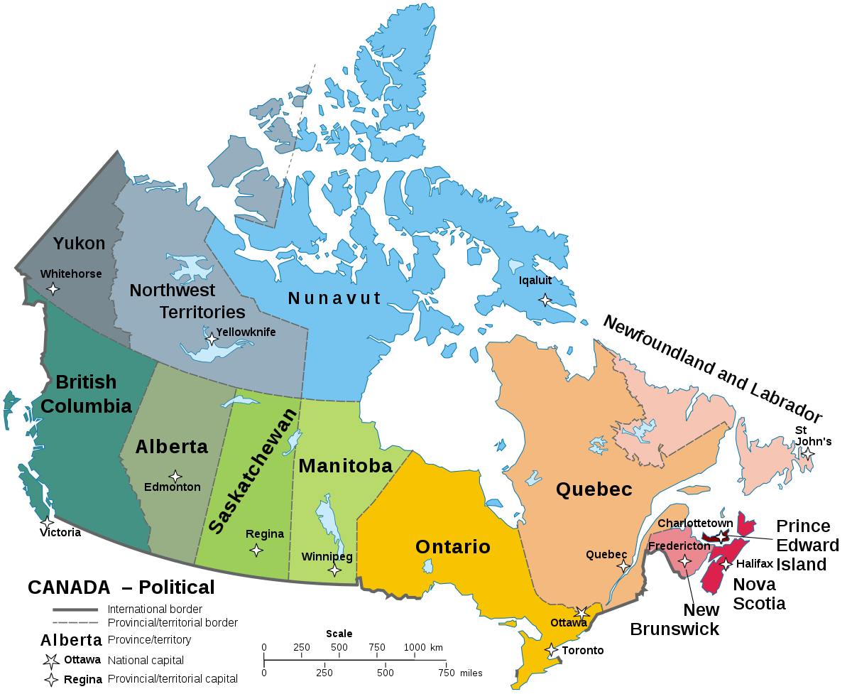
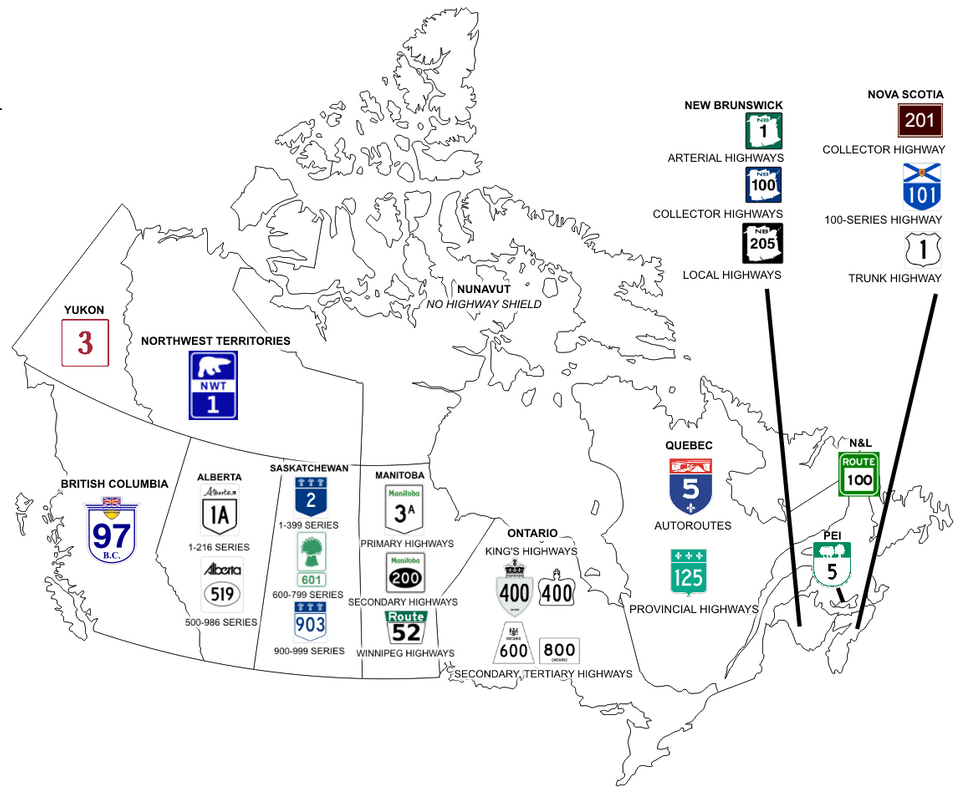
This map shows the 10 provinces and 3 territories (Yukon, Northwestern territory and Nunavut) with their capital :
You can train provinces and capitals with those Seterra quiz :
- Cities
A few tricks may help you find your general area:
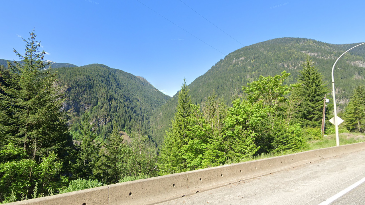
Some landscapes are easily recognizable :
-Mountains are in the west of the country, that is to say mainly British Columbia and sometimes Yukon.
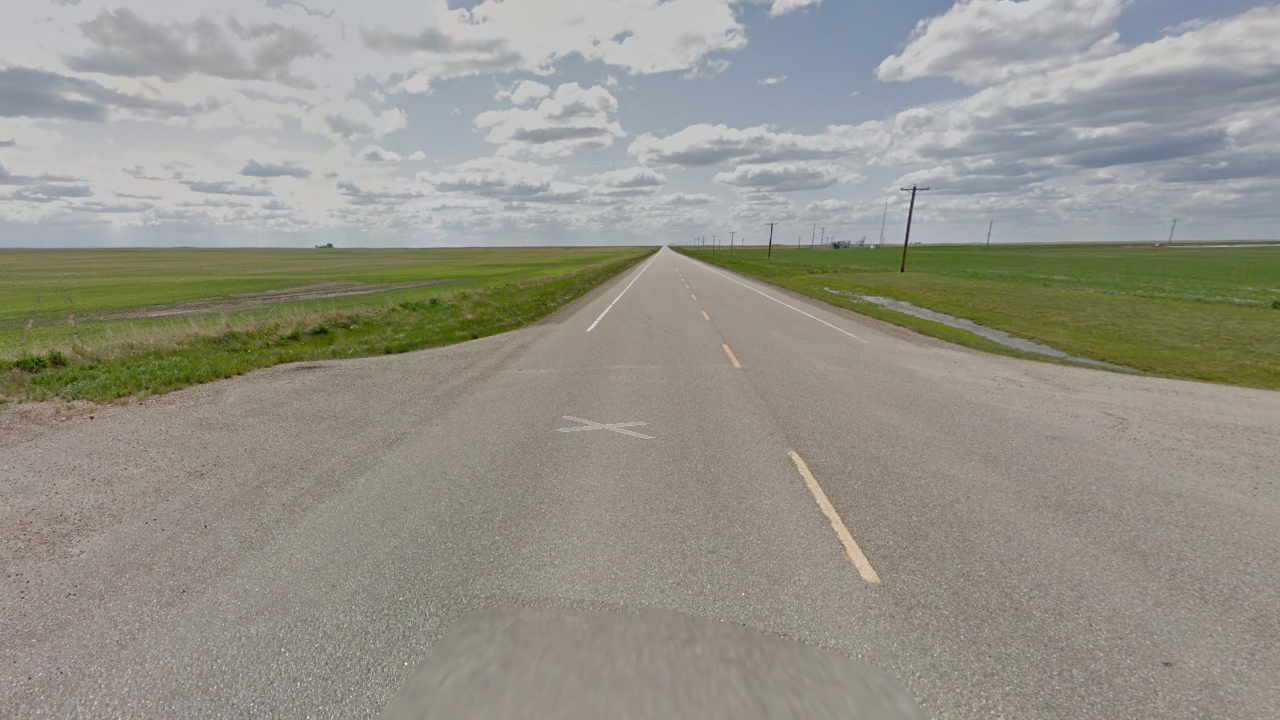
-huge agricultural plains are in Alberta, Sasktachewan and Manitoba. The roads there are straight lines, going exactly north-south or exactly east-west.
French language :
-Quebec is the only province speaking french only.
-New Brunswick is the only province where both french and english are both official languages.
-Two provinces have many french names for places, despite speaking english : Newfoundland and Manitoba.
Identifying provinces thanks to road signs
It is quite easy to tell the province given some road signs. Here is a specific geoguessr map to train : Canada provincial road signs
Provincial shields
Each province has distinct shields for provincial roads :
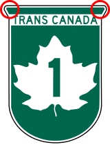
If you find the transcanada highway with its green maple leaf, you may tell the province :
-if you can zoom enough, the province is sometimes written on it.
-in Newfoundlands, there are specific corners at the top of the logo :
-Transcanada is usually road number 1, other numbers are in specific placess. No need to learn them, it's easy to see on the map.
-number 2 is in New Brunswick.
-number 16 starts from Winnipeg and goes to British Columbia.
-number 100 is the Winnipeg ring road.
-numbers 103 and 104 are in Nova Scotia.
Some specific signs.
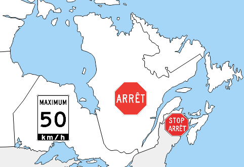
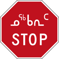
Stop signs are written "Stop", except in Quebec ("Arrêt") and New Brunswick ("Arrêt Stop").
Ontario speed limit have a unique black line underneath.
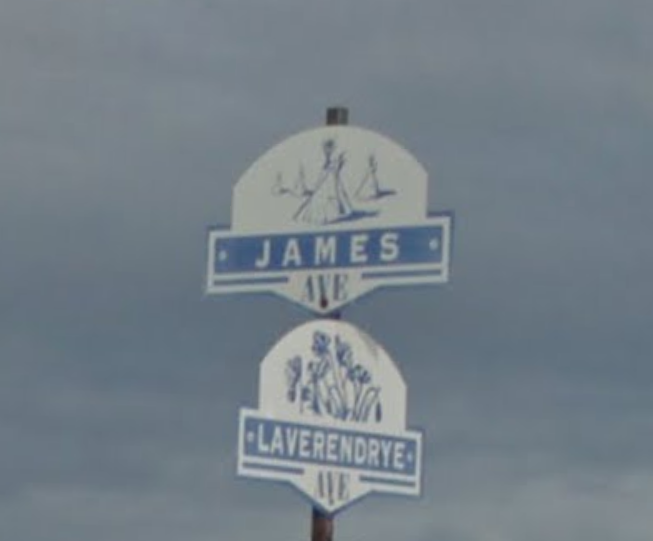
Street signs
In most of the country street signs are in english : street abbreviated ST, Dr for drive, ...
-Quebec has french names such as "rue".
-if you have double abbreviation such as : "39 e/th" for "trente-neuvième/thirty ninth", "Rue St" for Rue/Street, "dr prom" for drive/promenade, "cour ct" for cour/court, and even "av ave" for avenue/avenue. Then you are most likely in New Brunswick, Prince Edwards Island, or near Ottawa in northern Ontario.
Differentiate dirt roads in Alberta, Saskatchewan and Manitoba.
Those 3 states have a square road grid. Each road is numbered, intersections are easy to find if you know in which province you are.
In manitoba dirt roads are called "road", abbreviated "rd". Horizontal roads go from 1 at the US border frontière USA with increasing numbers the further north you go. Signs will show you "Rd 12 N" ou simply "12 N". Vertical roads are named East or West, depending on their position compared to Winnipeg. For example "Rd 25 E" or "25 E" is the 25th road when you go east from Winnipeg.
Saskatchewan and Alberta use Range Road ("rg road") for vertical roads and township roads ("twn road") for horizontal roads.
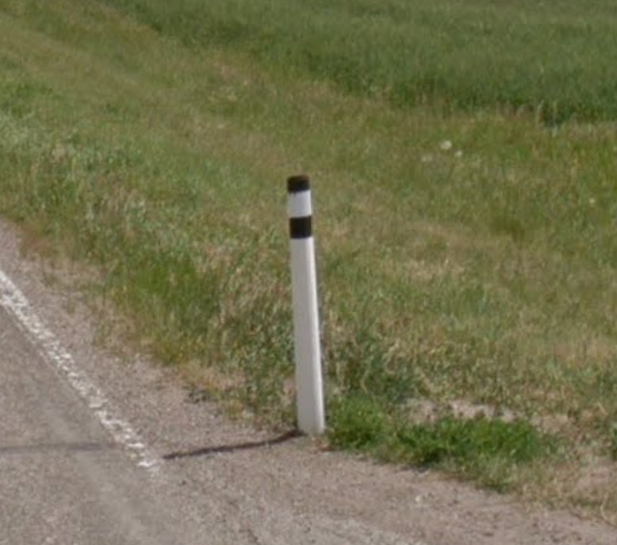
One way to be sure that you're in alberta is if you see the specific bollard with 2 black lines at an intersection.
Phone numbers
Landlines in Canada are 3-digits area code followed by 7 digit phone number. They look like this : 640 123 1234.
There are 2 types of area codes, primary codes which are historic, and secondary codes introduced when they had no more numbers to give.
Secondary codes are kind of useless since it's rare to find them, so i recommend you focus on learning only the historic ones, it makes it a lot easier to learn.
The map of the main area codes :
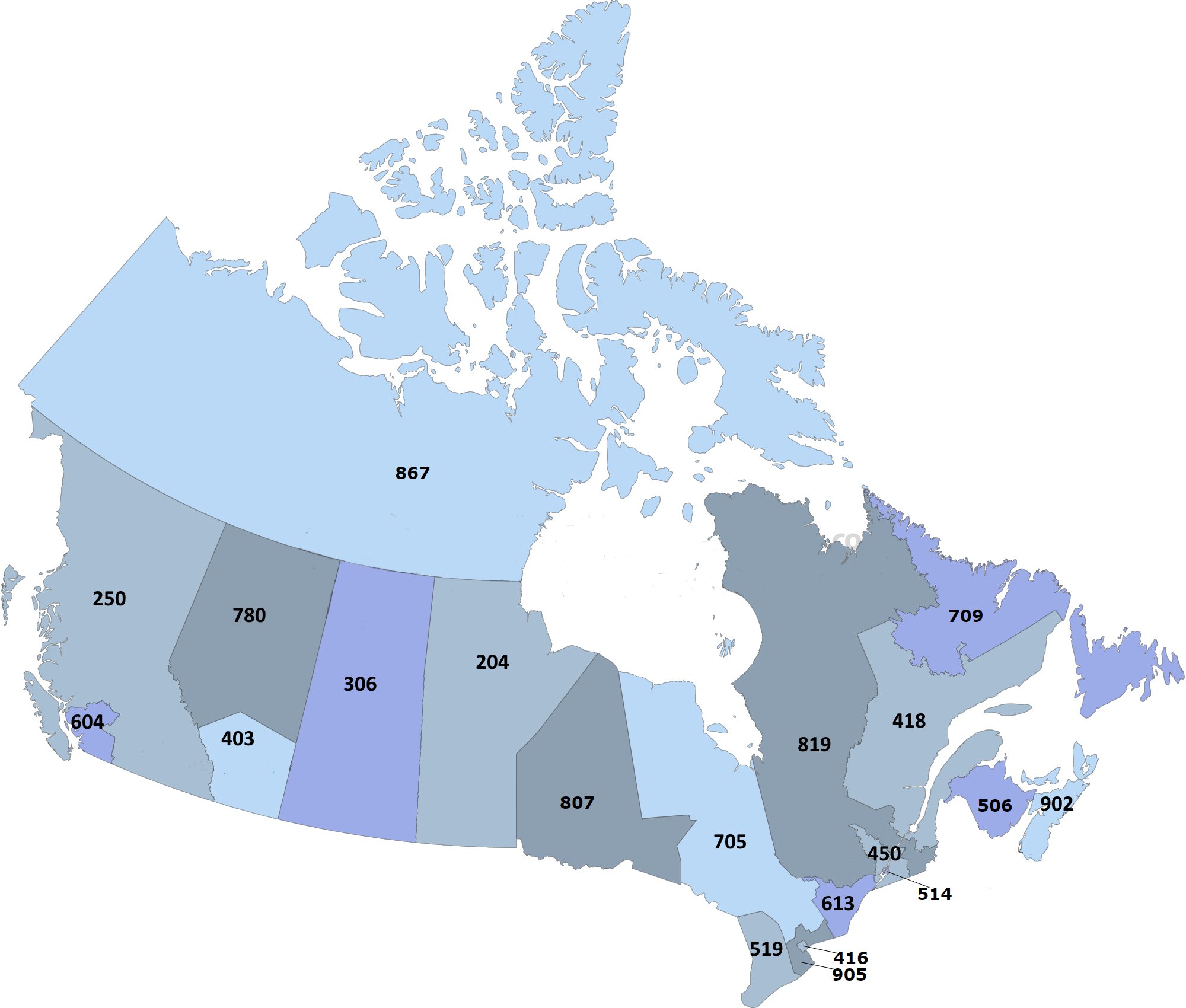
To train, i made this geoguessr map : Canada : area codes / phone numbers
And also the Area codes quiz.
In canada, some remote places have streetview coverage, they're hard to find unless you already know them. Here are some of them :
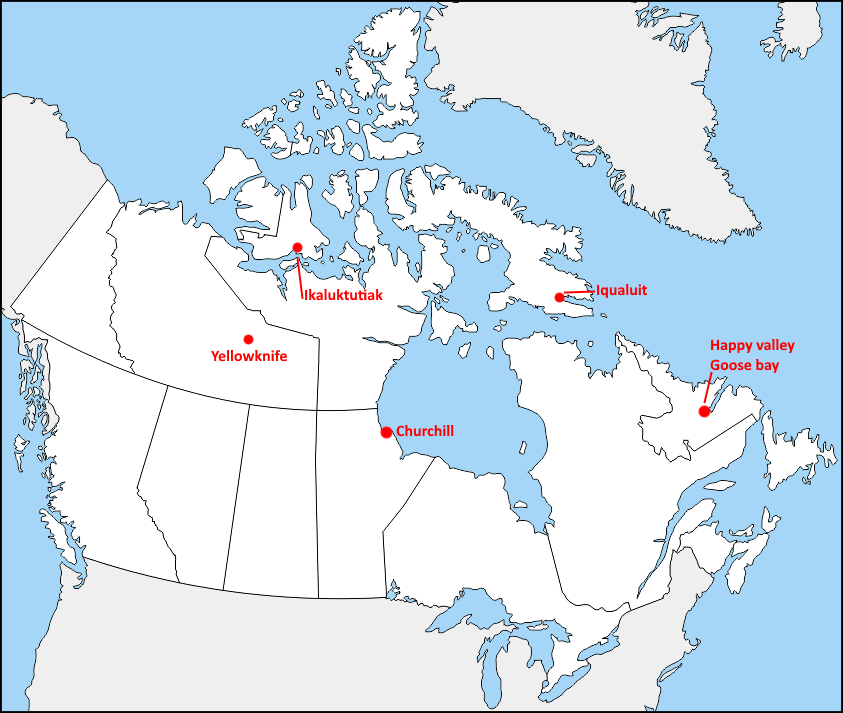
Specific area : Iqaluit
The city of Iqaluit (ᐃᖃᓗᐃᑦ : lot of fish) is the capital of Nunavut. There, you can recognize the Inuktitut script and the snowy streetview.
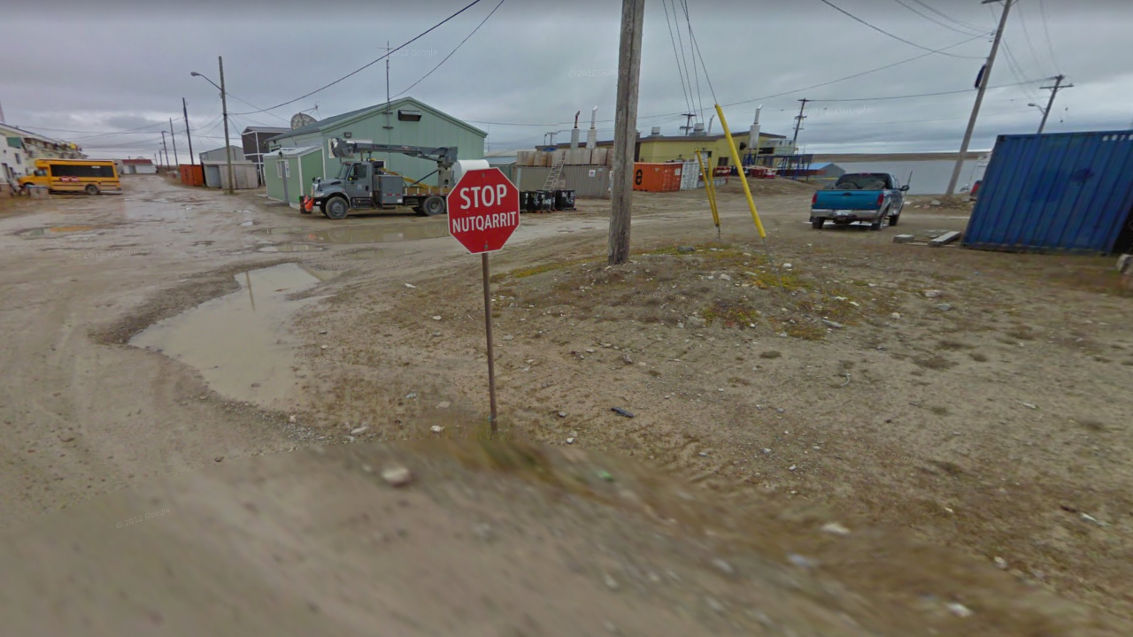
Specific area : Ikaluktutiak
The city of Ikaluktutiak (= a nice place to fish) can be recognized thanks to its stop signs and muddy streetview.
Specific area : Yellowknife
Yellowknife, north of the great slave lake, is the only city with coverage in northwestern territory. The road to Yellowknife going through Enterprise and Fort Providence also has coverage.
Specific area : Churchill
Churchill is famous for its polar bear. The city itself has streetview coverage, where you can see its unique street signs. There are some trekkers around the city.
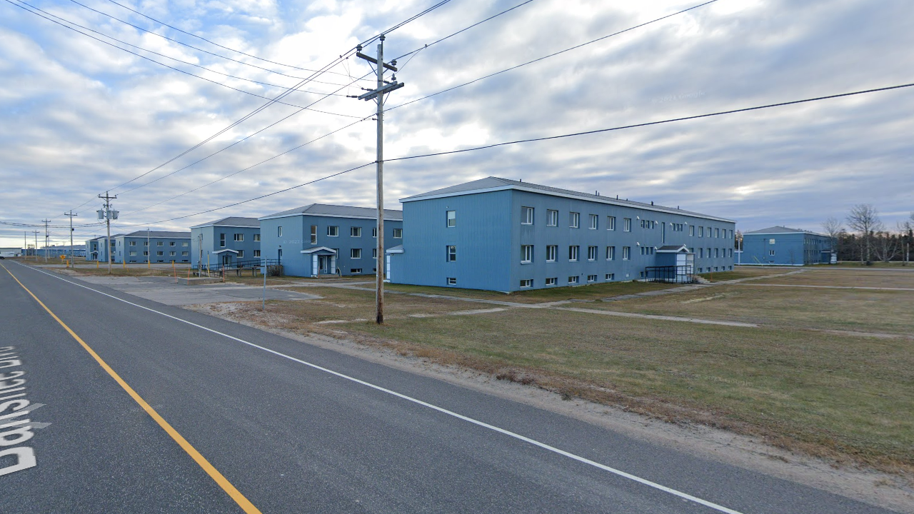
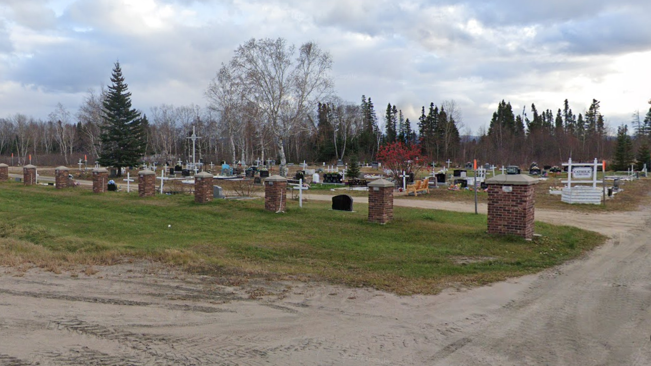
Specific area: Trans Labrador Highway and Happy Valley - Goose Bay
If you feel like the sun is blinding you, you're likely on the Trans Labrador Highway going to Happy Valley - Goose Bay. The city itself has a "blue district", and the cemetarry at the south of the town is quite unique.