


Introduction
The Philippines is a 7.000 islands archipelago. Several languages are spoken, the most common is called Tagalog. Spanish family names and location names are fairly common. The use of english is widely spread, since it used to be an american colony.
The main islands
The biggest islands are Luzon in the north and Mindanao in the south. The archipelago between Luzon and Mindanao (Samar, Leyte, Bohol, Cebu, Panay, Negros, etc...) is called Visayas. Palawan is a special case, it is a little further away, geologically speaking it is not part of the archipelago.
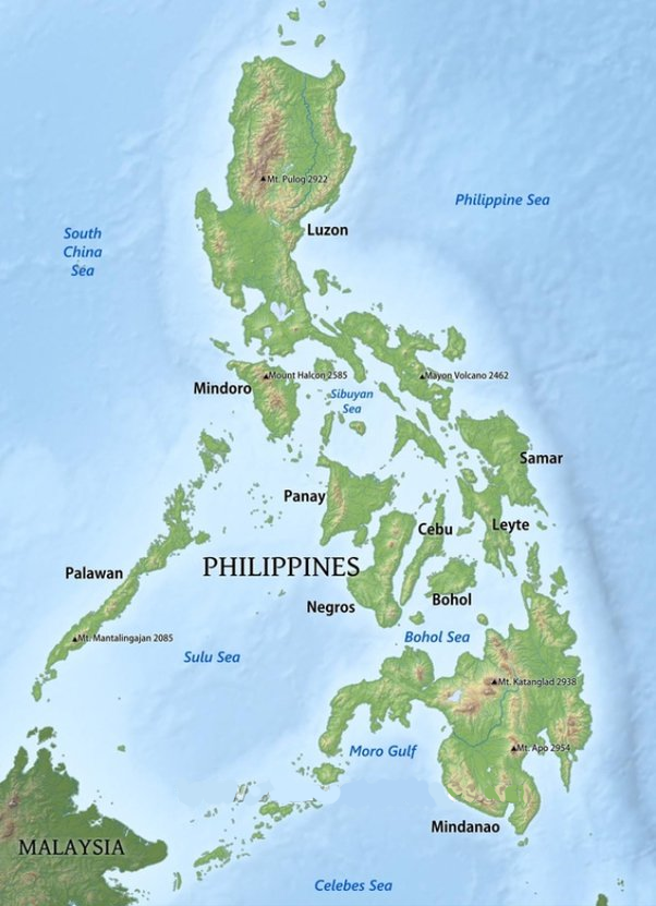
From a cultural point of view, Mindanao is different from the rest of the country. During the spanish reign, the south of the island was an independant muslim sultanate allied to the indonesians.
Religions
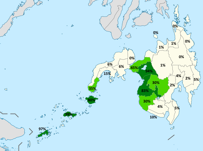
According to census, less than 1% filipinos have no religion, and 90%+ are christians. In Mindanao, as you can see on the map that shows the percentage of muslims in the population, there are huge differences between provinces :
Administrative divisions
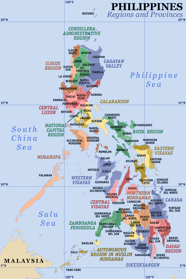
The Philippines are divided in regions, then in provinces, then in municipalities, then in barangays (BRG ou BRGY). In urban areas, a barangay is the equivalent of a district, in rural areas, it is a village.
Regions are quite theoretical and do not have much weight, the real political and economic subdivisions are the provinces. So you will always find the name of the province but almost never the name of the region.
Even though there are some tips and tricks, the only way to be good in this country is to know the provinces.
Provinces
Province names are not shown on google map, you need to know their name and location. Sometimes, the province name matches the island name or the province capital name, in which case you can find it on the map.
To learn them, there is this Seterra quiz.
Good to know
-The province of Manila is named National Capital Region, abbreviated NCR.
-There are Palawan pawn shops all over the country, it is a brand, dont mistake Palawan pawn shop for Palawan island.
-In the north of Luzon, there is the Cagayan province, in the Cagayan Valley, in which you can find the Cagayan river. On the other side of the country, there is a major city named Cagayan de Oro.
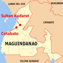
-After administrative modifications, the city of Sultan Kudarat is not in Sultan Kudarat province anymore, just like Cotabato city is not in Cotabato province :
Big cities
The City quiz enables you to learn the cities.
Knowing the cities is quite usefull and you might gain a lot of time on your rounds thanks to it.
Precise guesses
Once you have found your province and municipality on the map, you will need to look for your exact location, usually using the name of you barangay. To find your barangay, you will have to look for points of interests with the barangay name.
many names are offset on the map
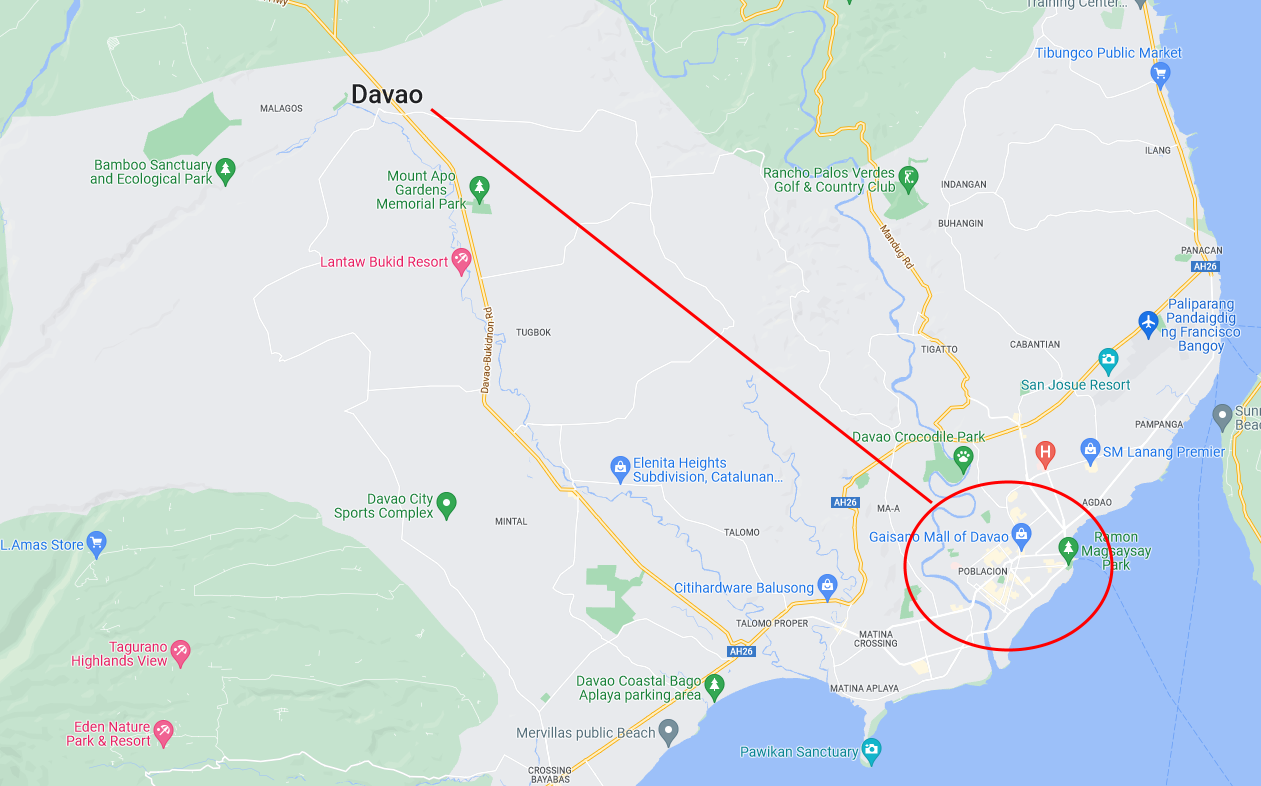
Municipalities and barangay names are often not where they should be on google maps. To find the right place, scan the main roads and look for points of interests.
Example 1 : The city of Davao is written on a road in the middle of nowhere, while the real city is on the coast, with a point of interest "mall of davao" easy to spot :
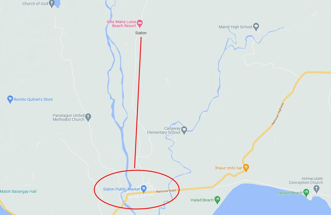
Example 2 : If you look for Siaton in the South of the Negros island, you can spot the name, but the real village is on the main road where you can see the public market :
Far away barangays
Some municipalities are very large, and barangays may be quite far from the main city.
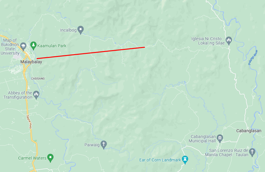
Example : This sign gives us all the informations, Bukidnon province, Malaybalay municipality, barangay Can-ayan.
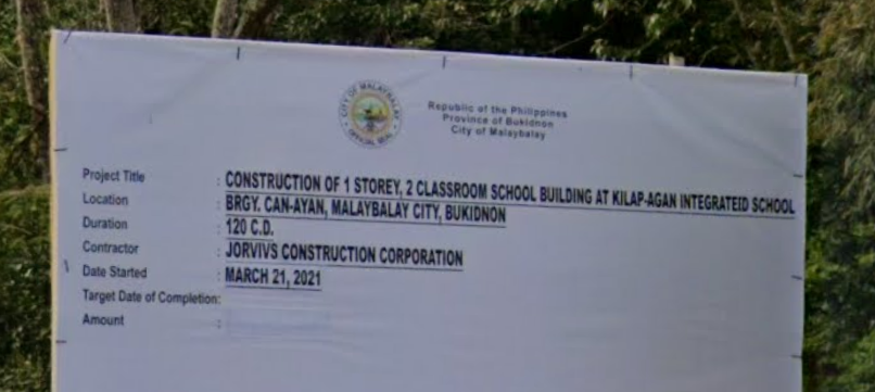
However our actual location is quite far from Malaybalay, in fact it is almost impossible to find unless you zoom on the river to see it is called Canayan.