


Introduction
Puerto Rico is an "unincorporated territory of the United States", which is the last step before becoming a US state. There will be a decisive vote on the matter in 2023.
The islands
The main island is Puerto Rico. In the east, Vieques and Culebra are inhabited islands. There are some other uninhabited islands, notably Isla de Mona in the west. Streetview coverage is limited to Porto Rico island, so the secondary islands do not matter unless you're in a photosphere.
Note : In the west, only the coast and the main yellow roads have streetview coverage.
San Juan
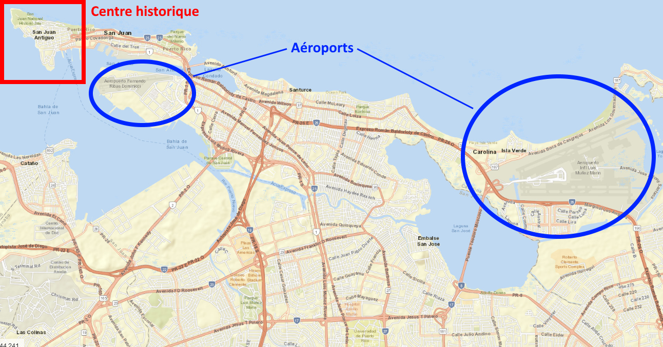
The capital is San Juan, a huge city in the north-east. The historic center with forts, paved roads and big colonial style buildings is located on la Isla San Juan, north of the main city.
Road signs
There are 4 categories of roads each with a distinct shield :

However you do not need to differentiate them since the road number is unique and good enough to find your road.
Numbering system
Main roads are numbered 1 to 99, there is no particular order but they're big easy to spot roads.
In the range 100 to 198, road numbers increase from west to east, with one exception being 199 south of San Juan.
Then, there is a specific area for roads 200s and 2000s, one area for roads 300s and 3000s, ...
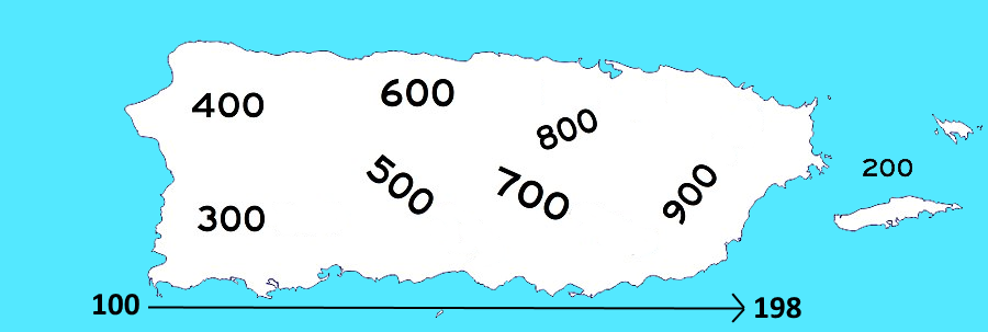
On 4 digits roads, the first digit is always the area code. Then the 3 following digits very often refer to a nearby 3 digit road, but it is not always the case.
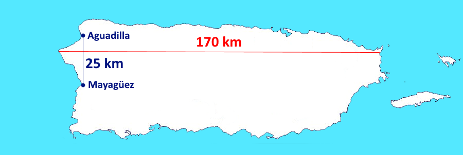
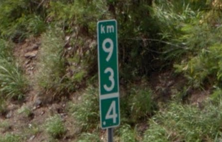
Distances
To have arough idea of distances on the island :
On many roads, you will find kilometric signs. Kilometer 0 is in San Juan if the roads leads there.
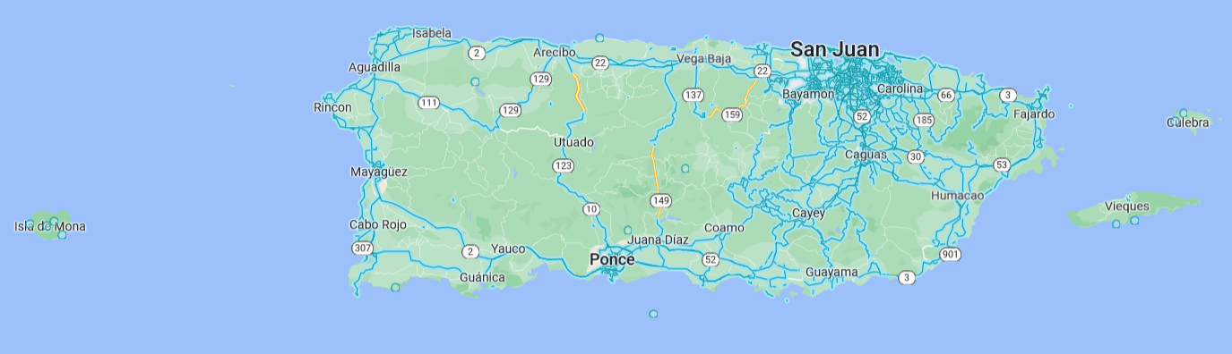
Municipalities
Map of the main cities :
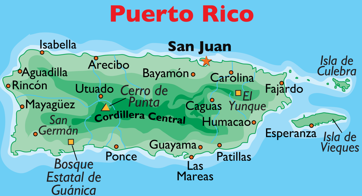
To learn the cities, you can use the City Quiz or the 78 municipalities quiz on Seterra.