


Introduction
In Taiwan there are lots of information in the streetview that will help you find where are.
This page shows you the basics, the other tabs describe in detail the most usefull meta :
-Roads.
-Electric poles geolocation system.
-Phone numbers area codes.
Geography
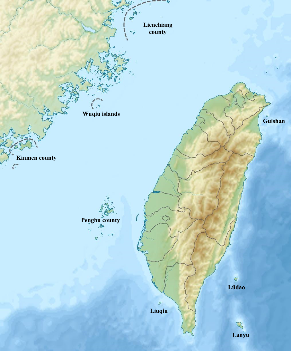
Taiwan has a main island and quite a few secondary islands, some of which are quite near continental China.
The Chungyang mountain range (Zhongyang shanmo in chinese) covers the center and eastern part of the main island.
All the islands have streetview coverage except the small Wuqiu islands.
Counties
Taiwan is divided in 22 counties, often named after the capital of the county, followed by the title "county" or "city".
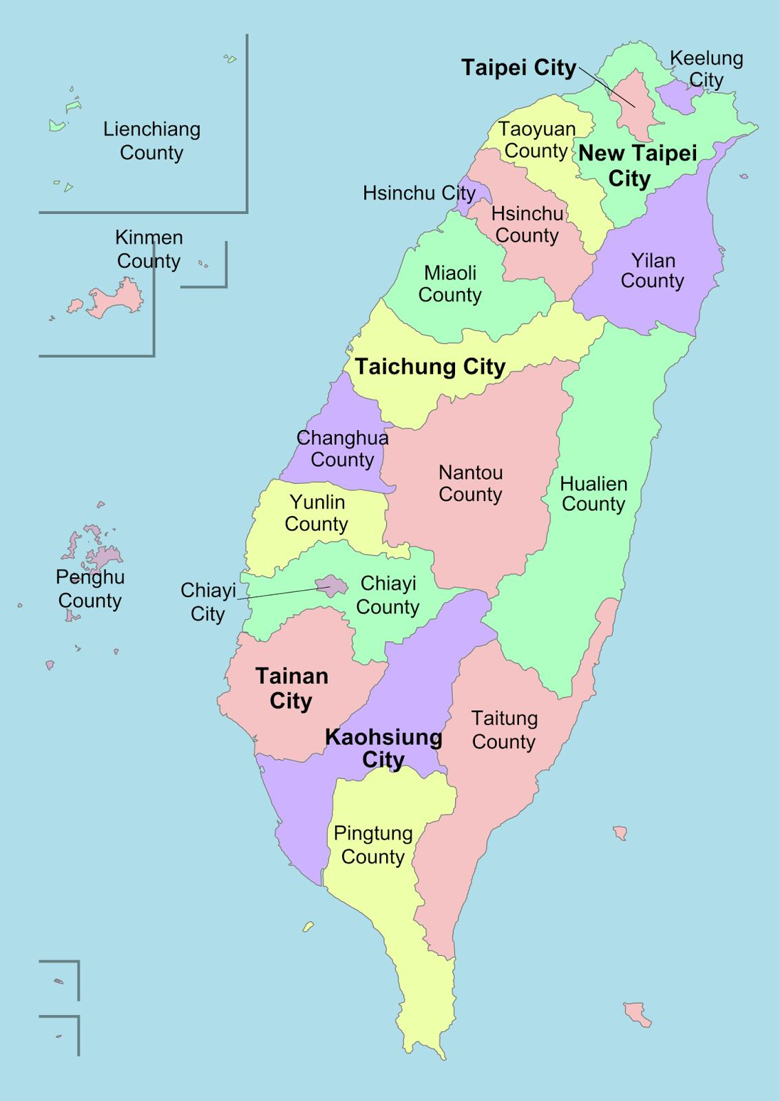
This Seterra quiz lets you learn the counties.
There is the City quiz if you want to learn the cities.
Electric poles markings
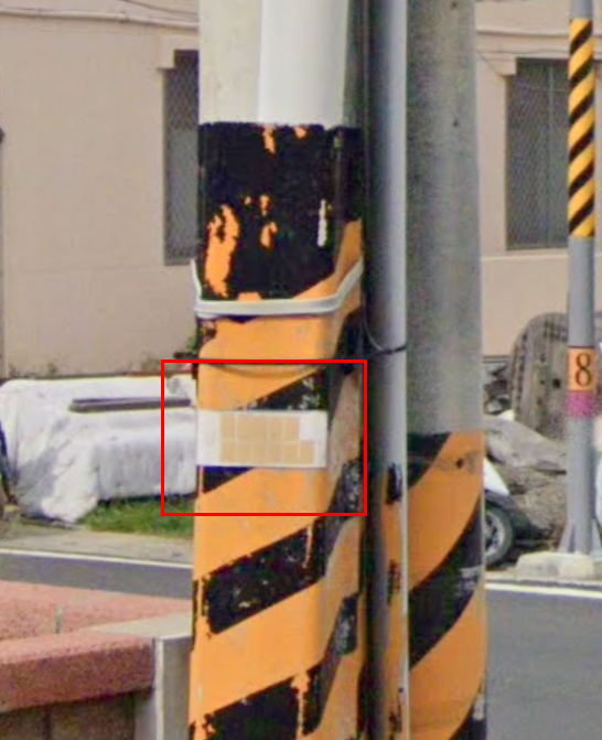
On the main island, there is a blue plaque screwed to many of the electric poles.
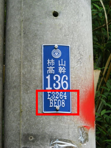
The string "E3264 BE08" on the image is the location of the pole in a coordinate system specific to the Taiwan power grid, which indicates the location of electric pole with a 10 meter precision.
The theory
We take our example "E3264 BE08", and read left to right.
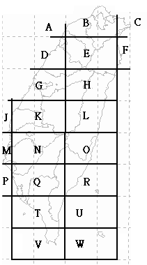
The most important information is letter E, which gives us a 50 km by 80 km rectangle.
The second most important information is "3264", it tells us that within rectangle E, we are 32% eastward and 64% northward.
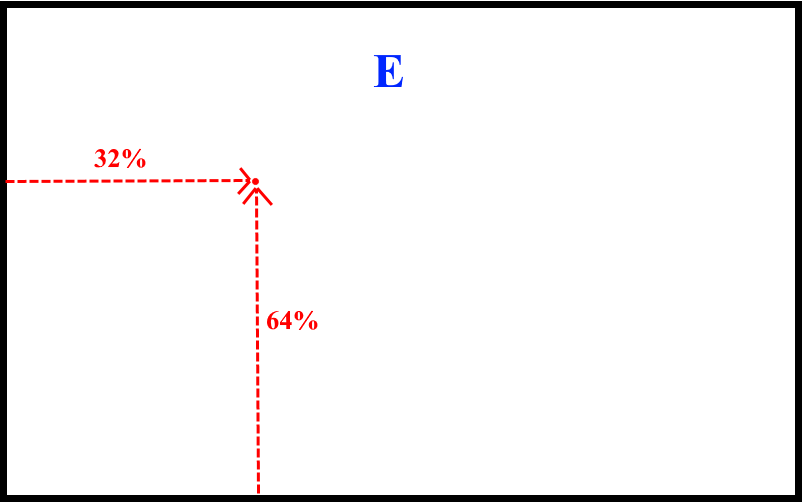
The string "BE08" is for precision but it is of no practical use ingame.
If you want to know more about this coordinate system, this wiki page ewplains how to translate them in TWD67 coordinate system, which can then be converted in classic WGS84 coordinates.
In practice
You can train with the Taiwan power grid quiz and the geoguessr map named Taiwan power grid coordinates. Once you know the repartition of the letters, remembering 6 or 7 points is good enough to recreate the whole grid.
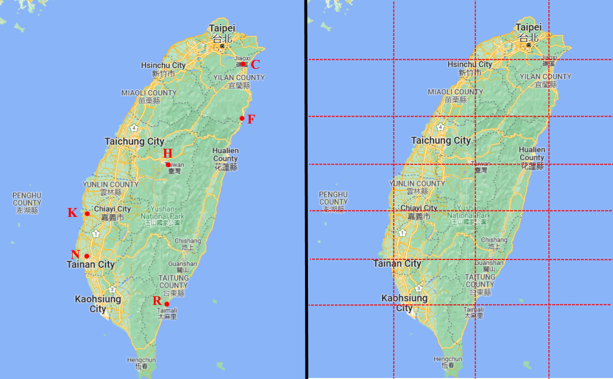
The easiest landmarks are :
-B slightly north of Hsinchu, C in Jiaoxi.
-F in Nanao township, on the west coast the border between Miaoli county and Hsinchu city is on the same horizontal.
-H is near Puli, where the google map indicates either Taiwan or Nantou county depending on the zoom.
-K is n the west coast at the border between Yunlin county and Chiayo county.
-N is just north of Tainan city, on the same horizontal you find Guanshan.
-R is in Taïmali.
Secondary islands
Letter S is for Liengshang county.
Letter X is the northern part of Penghu county, Y is the center and southern part of Penghu county. Penghu county doesnt use the blue plaque, it uses instead a white band with yellow spots for the letters.
Z is for Kinmen county, but it's hard to find a marking there.
Roads
There are 4 types of roads in Taiwan :
- National freeways : flower symbol.
- Regional highways : blue or red triangle.
- County roads : white square.
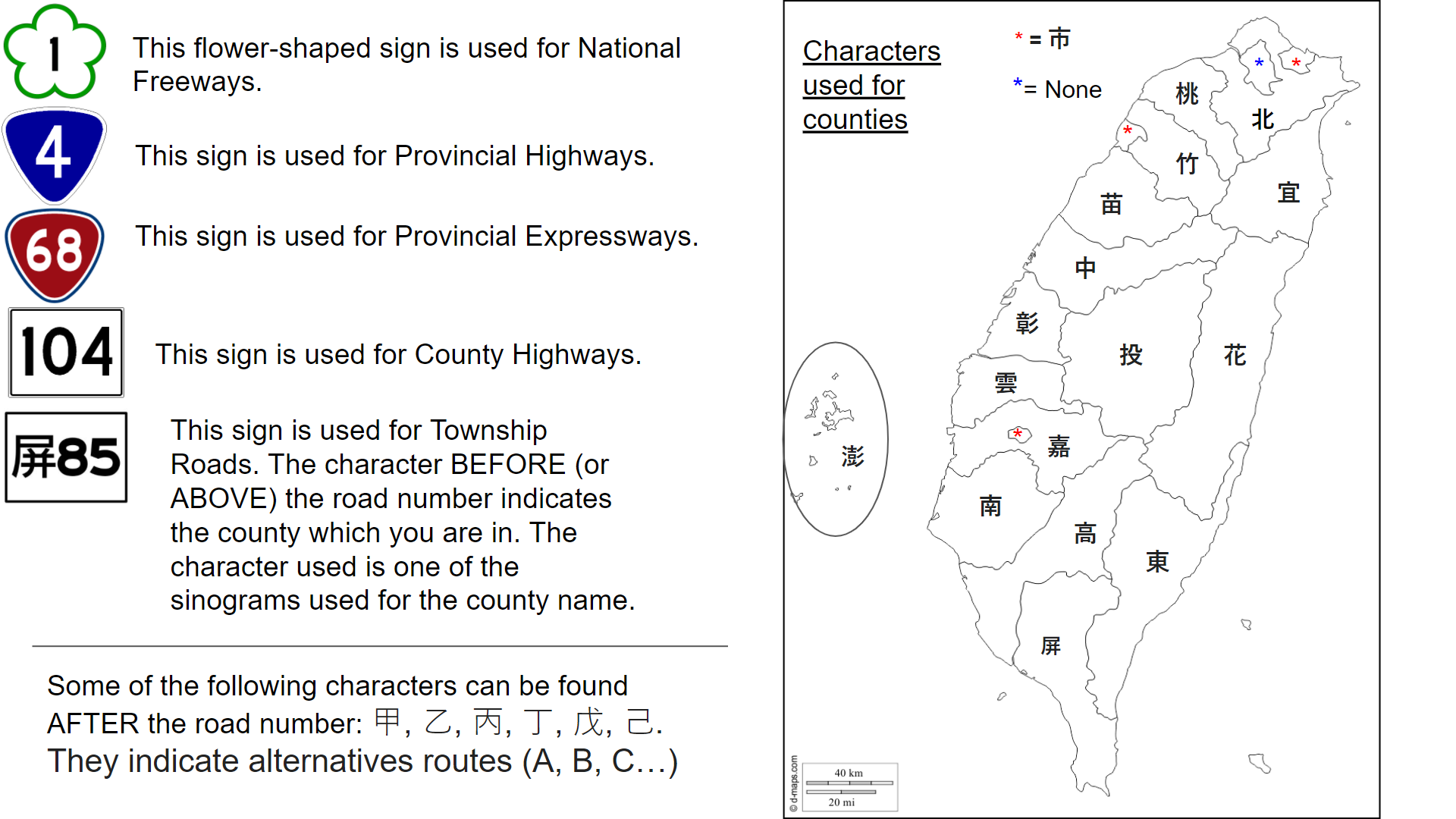
- Township roads : they have a county symbol in front of their number.
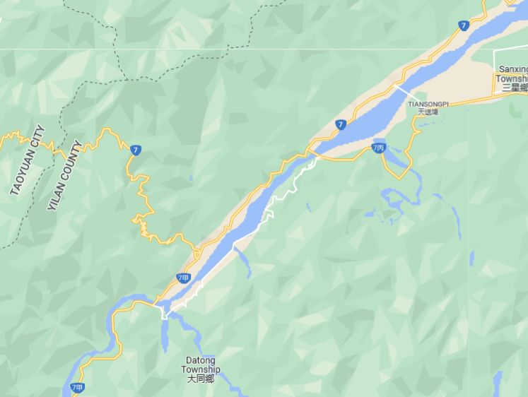
A road can be split in different sections, identified by a symbol after the number. For example road 7 has several branches, on the image you can see the equivalent of road 7A and road 7C :
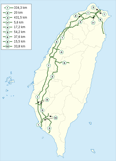
National freeways
National freeways are numbered 1 to 10. Every 100m, there s a kilometer sign telling you the distance with the north end of the road for north-south roads, or the west end of the road for east-west roads. Exit numbers also match this same distance.
Regional highways
On the map, the triangle logo appears in blue, unless the number is 60+ in which case they appear in red. Beware, the color on the map doesnt necessarily match the color in the streetview.
Some noteworthy regional highways :
-1 and 3 follow the west coast.
-2 follows the north coast.
-9 and 11 follow the east coast.
There is no global order but here are a few tricks : 2/4/6/8/10... until 26 go from north to south, 60's roads are rather north, 70's rather center, and 80's rather south.
County roads
They range from 101 in the north to 200 in the south.
Roads 201 to 205 are in Penghu county.
Township roads
Township roads have a symbol in front of their number.
You can learn the symbols with the township roads quiz Taiwan, but you can also find them by scanning the map. Indeed, the road symbol is one of the first 2 symbols of the county name :

Exception : Keelung city, Hsinchu city et Chiaoyi city all use the 市 symbol which simply means "city".
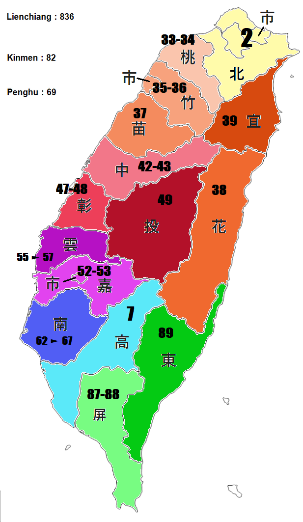
Taiwan area codes
In Taiwan, area codes range from 02 in the north to 08 in the south. 09 is for cell phone numbers.
You can learn them with the area codes quiz.