


Introduction
There are 3 things to master in Kyrgyzstan :
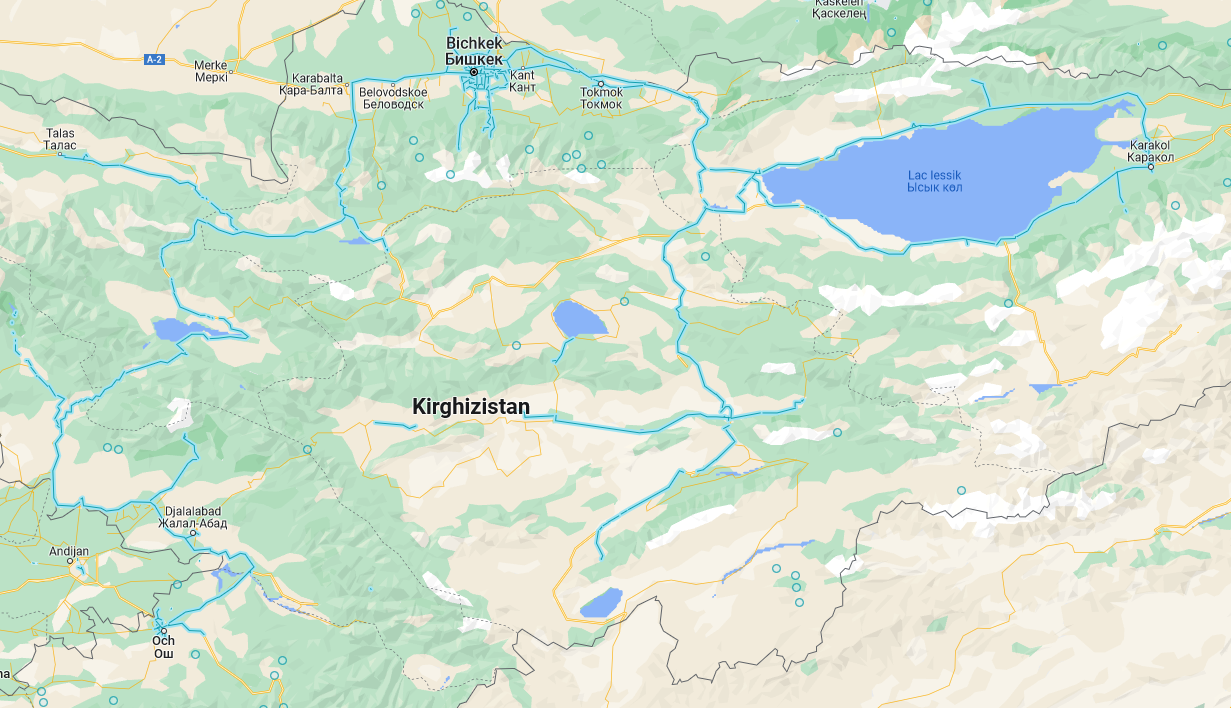
-the streetview coverage : it is quite limited.
-the rearview mirror meta : it divides the country in 4 main areas.
-the landscapes : i sorted them by type, it makes learning easier.
The easy guide focuses on basics : streetview coverage and rearview mirror meta. Then the places are sorted by landscape type, for each type there is an associated geoguessr map to train. You will learn faster if you focus on each part one at a time rather than trying to learn all at once.
If you want to play the whole country, the best geoguessr map i found is Kirguistan +12,900 locations.
Streetview coverage
Not all cities and orads have coverage :
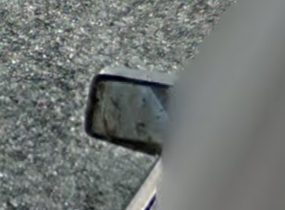
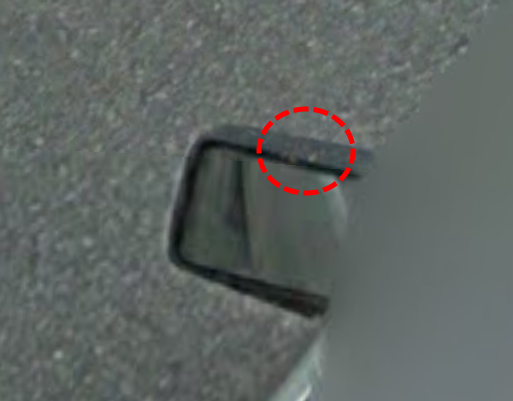
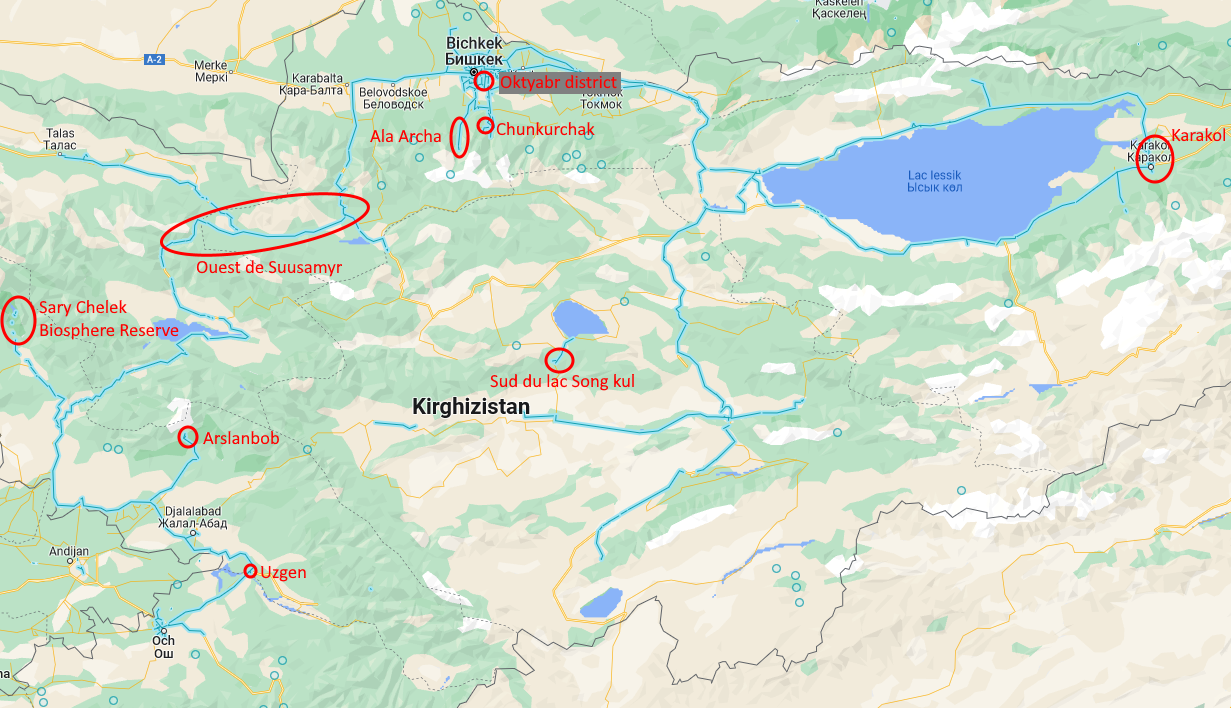
The rearview mirror
The left rearview mirror will tell you in what part of the country tou are :
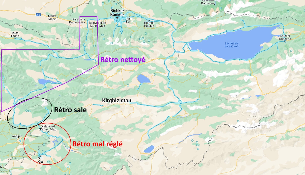
-the "normal" rearview mirror, as seen in the east of the country, in Bishkek, and in Tarlas valley.
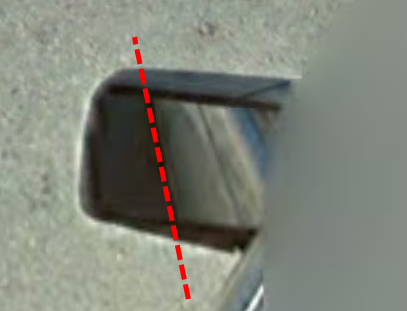
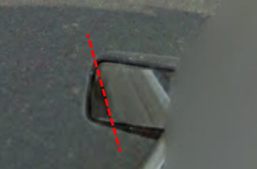
-the rearview mirror not properly adjusted, as seen in the south, mainly Och and Jalal Abad :
-The muddy rearview mirror as seen in the southwest, from Arslanbob to Tashkoumyr.
-le cleaned rearview mirror as seen in the west of the country (except Tarlas). There is still mud at the top but the mirror is clean.
Mountain valleys
This part is about narrow valleys. Road orentation will help you find your valley and also your exact location.
Training map : Kyrgyzstan valleys.
Map of the valleys
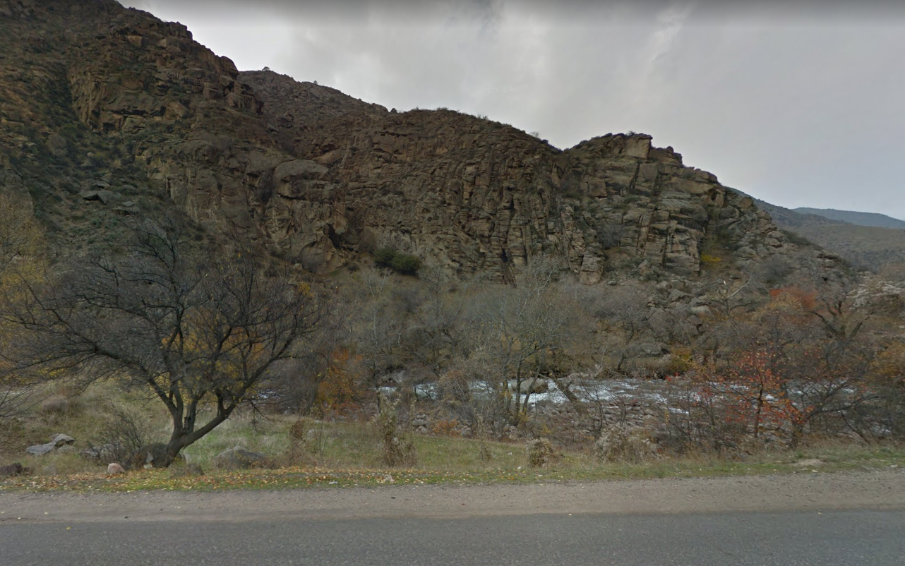
There are 3 types of narrow valleys : Tachkoumyr valley, valley with a main road, valleys with a small road.
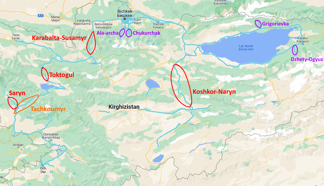
Tachkoumyr valley
Very easy to recognize thanks to the Naryn river that is quite large in this valley, and has a deep blue color.
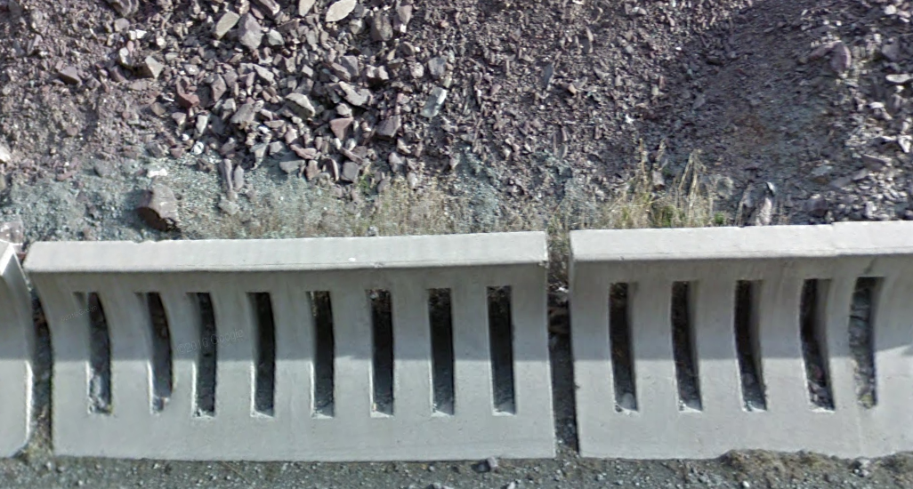
Valleys with a main road
Kara-Balta Valley has specific concrete blocks :
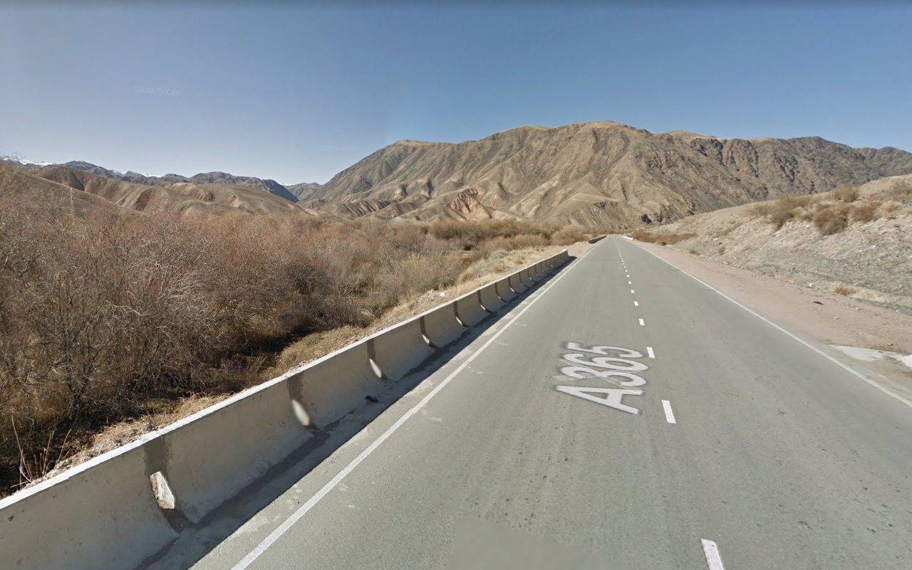
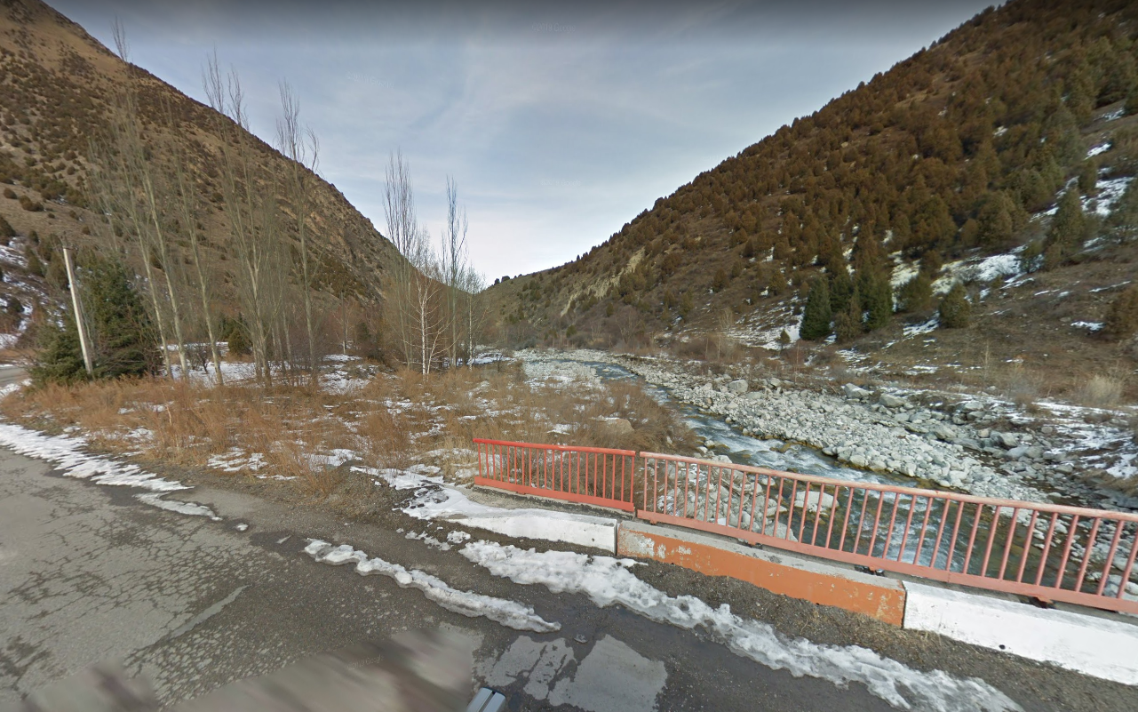
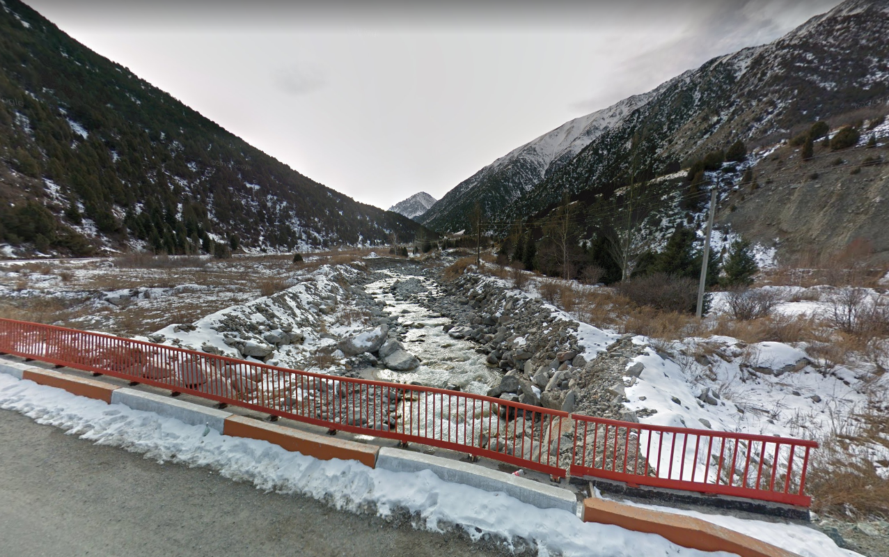
Toktogul valley has dry mountains, trees bordering the road, and some kind of torrent with fast moving water.
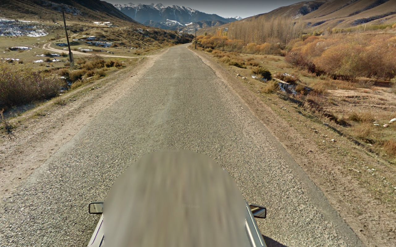
Koshkor valley leading to Naryn has a very arid climate. there is yellow/dry grass on the mountains, the trees bordering the road are small with no leafs. The river is small, sometimes you dont even see it. The road alternates between asphalt and dirt.
Valleys with minor roads
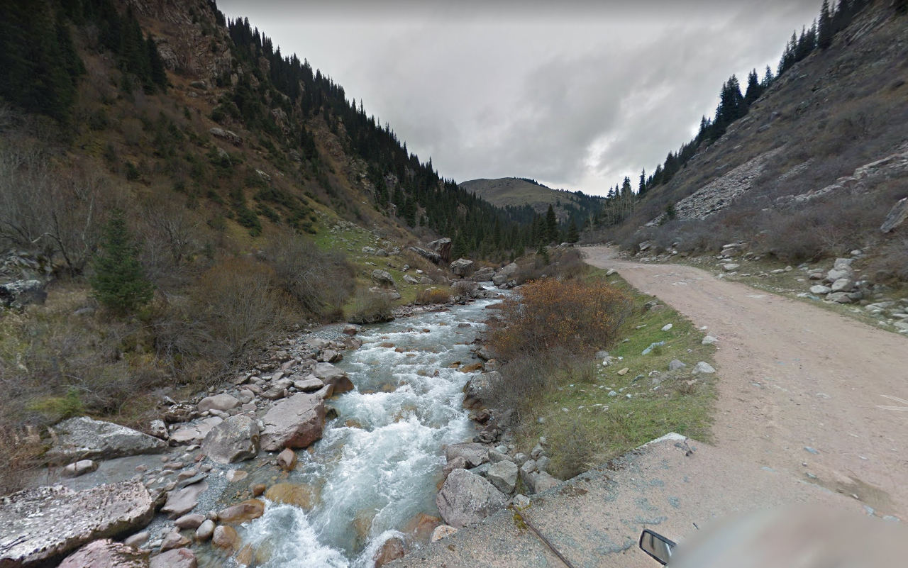
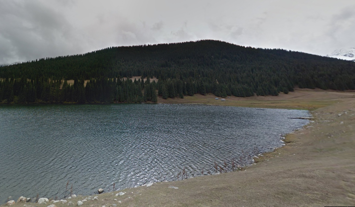
The valley north of Grigorivka is a dirt road along a torrent, you can see many pine trees. The road leads to a lake in a meadow.

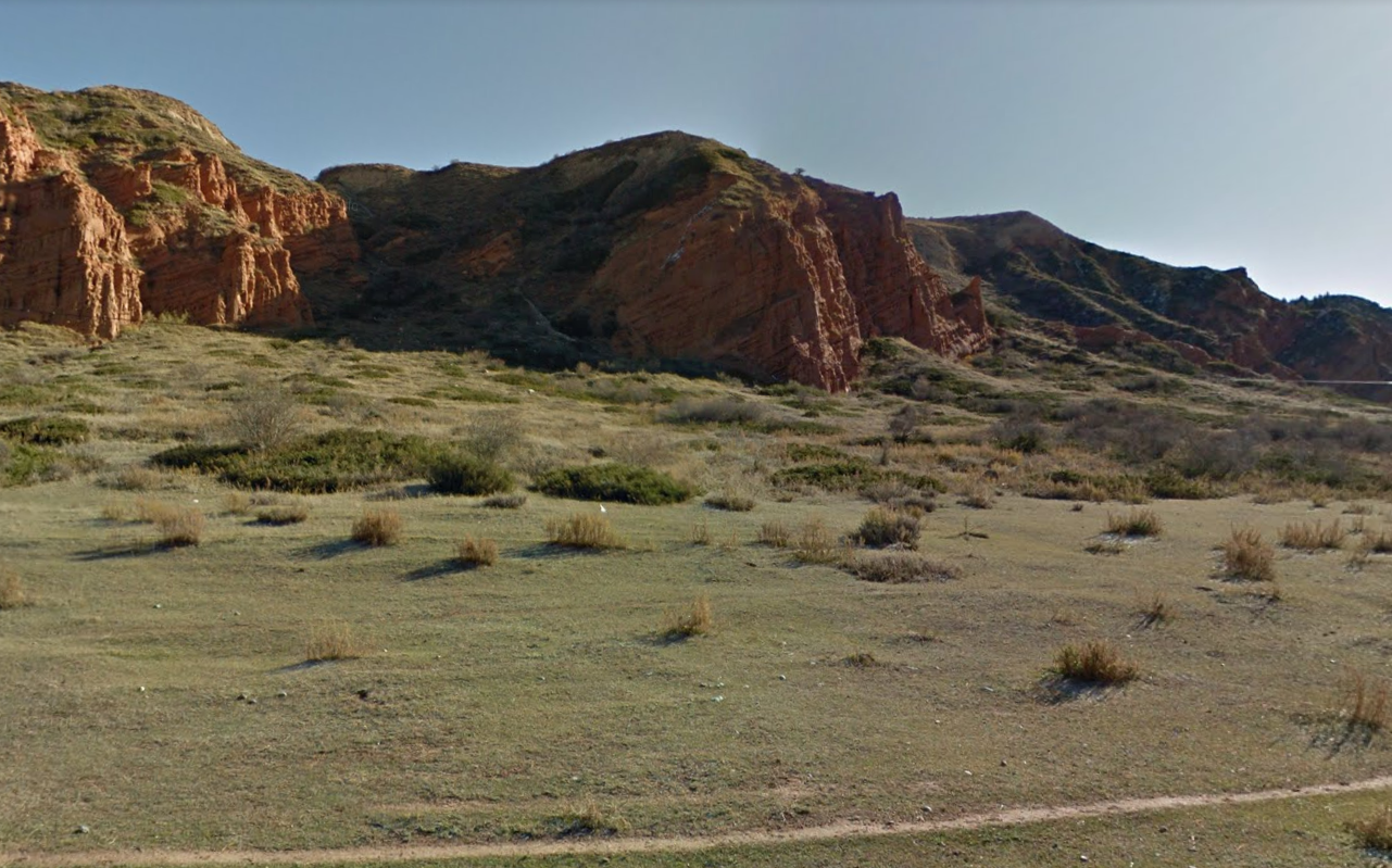
The valley south of Dzhety-Ogyuz has a granular road. The south of the road has a unique landscape, with green grass and red rocks.
In Al asha valley, wherever you are in the valley, if you look north you feel like it's the end of the snowy part, if you look south you feel like you arrive in the snowy part.
The valley east of Chukurchak has an asphalt road in bad shape, and you can se snow on the peaks of the mountains.
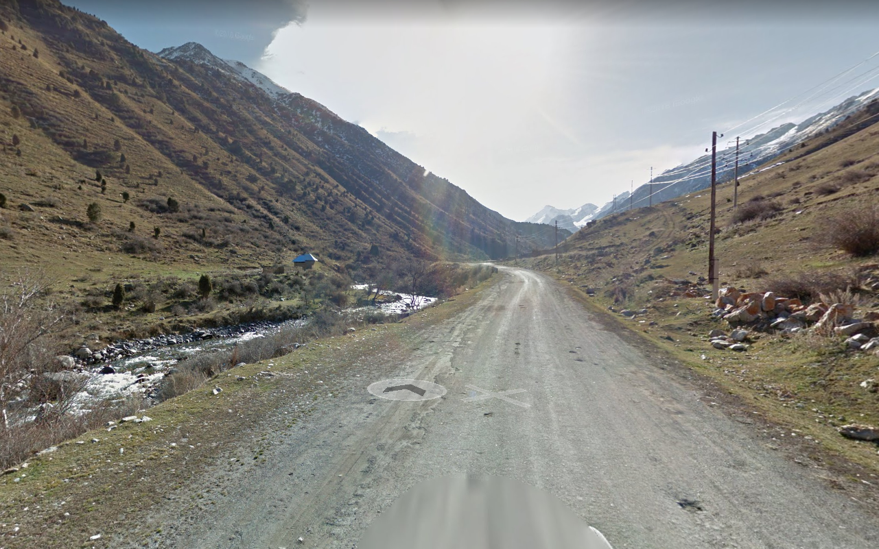
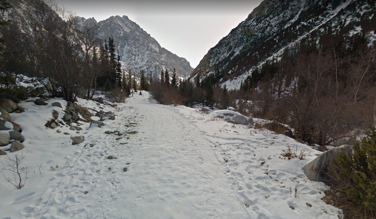
The Chukuchak valley has a dirt road. When you go at a higher altitude, there is a lot of snow (see the snow guide).
West of Suusamyr
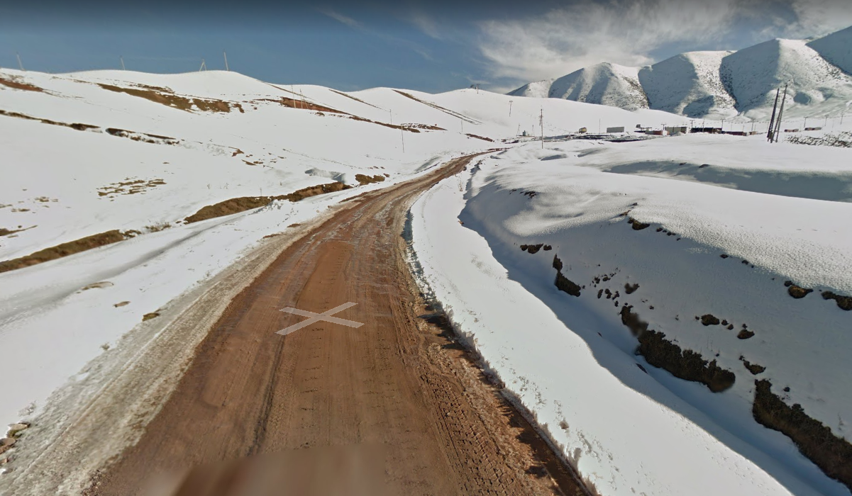
Very easy to recognize, a big asphalt road and heavy snow.
Cities
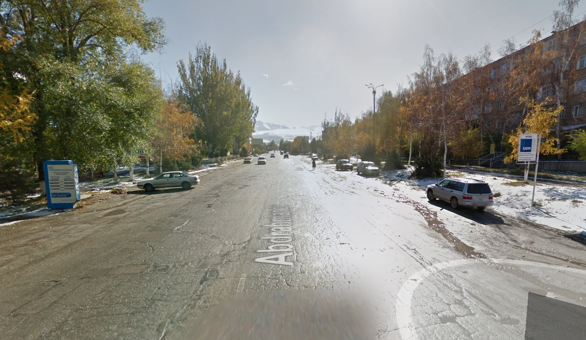
If there is snow on the ground and you're in a major city, it is either Karakol or Oktyabr District in Bishkek.
To tell them apart, Karakol has a sunny streetview where you can see a specific mountain in the south, while Bishkek's streetview is greyish weather.
The road north of Karakol also has snow, it is an asphalt road bordered with trees.
Uzgen is the only city with snow and the rearview mirror meta of the south.
ArslanBob is a big village, with the muddy rearview mirror. The road leading to Arslanbob also has snow.
Other places with snow
As i already said, in Al Asha valley, if you look north you feel like it's the end of the snowy part, if you look south you feel like you arrive in the snowy part. The south of the valley has a trekker with a large hiking trail.
Chukurchak is a mountain hamlet, the acces road is a dirt road with many zigzag. It looks similar to the south of Song-Kul lake.
South of Song-kul lake, there's an asphalt mountain road, it becomes flat when you go north.
Near Sary Chelek, the road itself has snow on it.
Lakes
There are 3 huge lakes, 2 regular, and 1 minuscule that have streetview coverage.
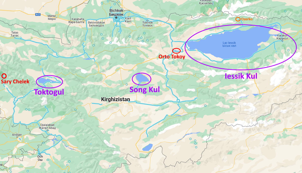
The training map : Kyrgyzstan lakes. Il y a volontairement très peu de points pour que vous puissiez tomber sur les lacs "rares" peu streetviewés.
Iessuk Kul
The biggest lake, you will know when you see it. The orad north of the lake is bordered with trees and looks like the Bishkek area.
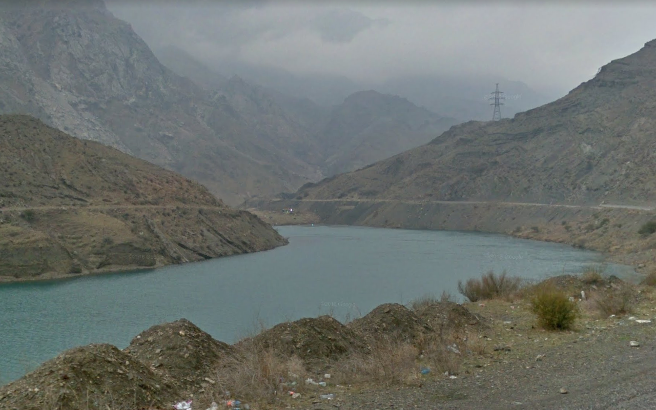
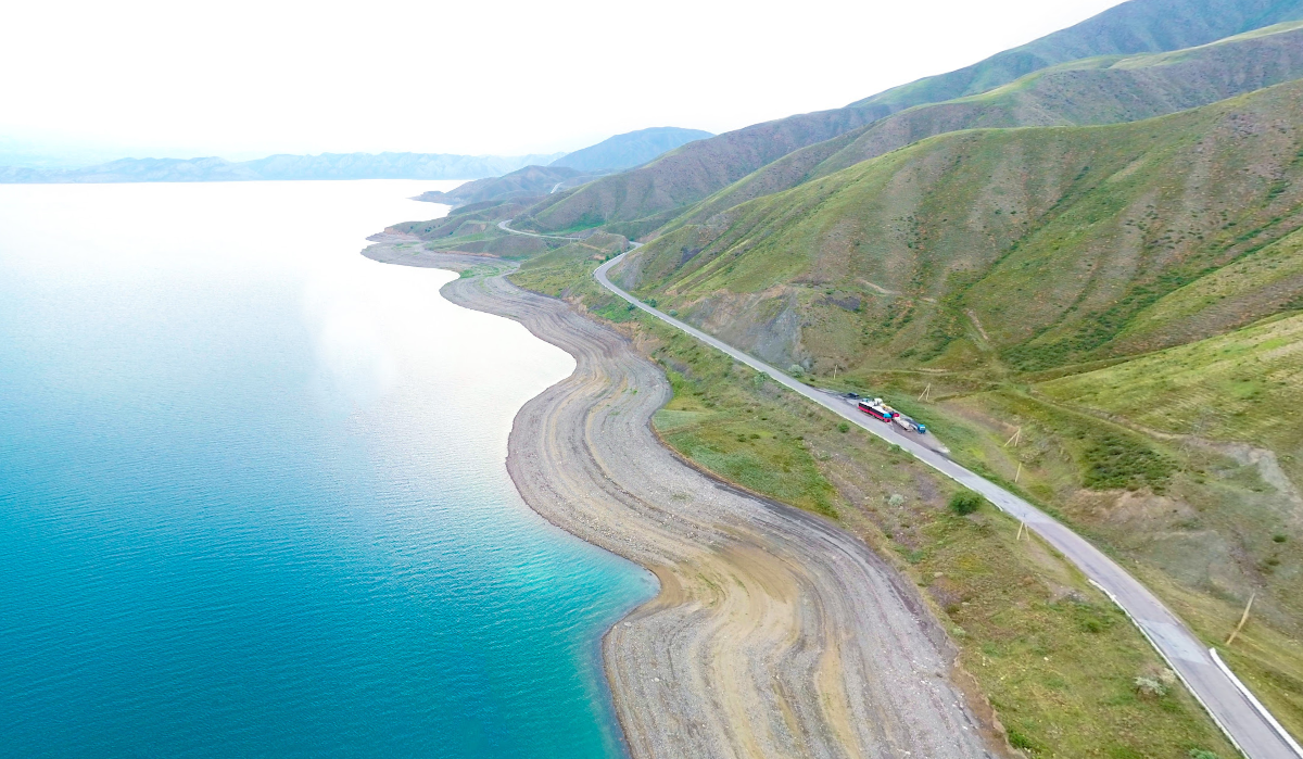
Toktogul
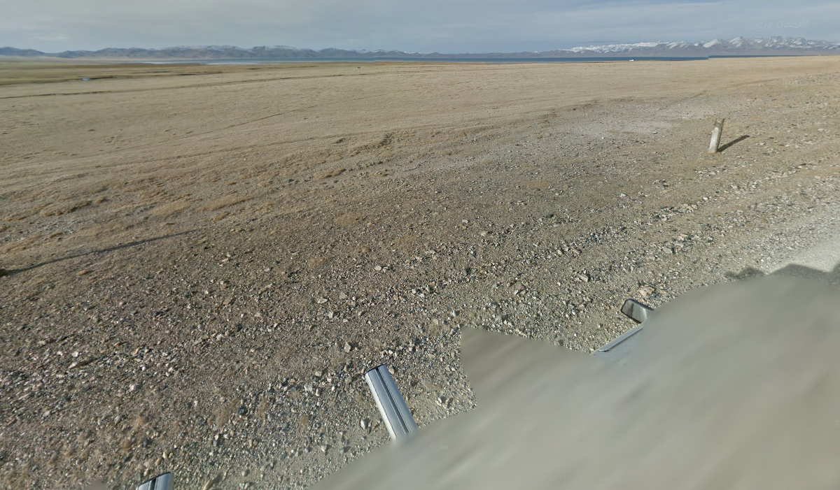
Toktogul is the biggest reservoir of the country. South of the lake, there are lots of concrete blocks. When you see the lake you can clearly see it is not at full capacity.
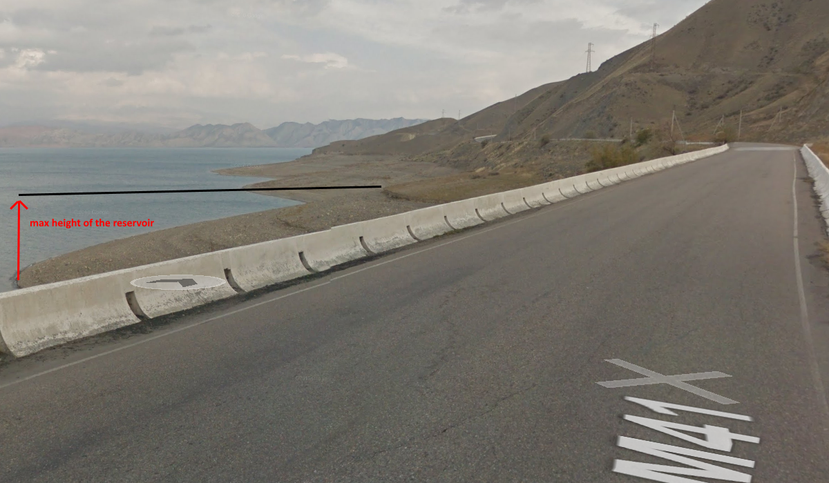
The road in the north of the lake leads to Toktogul, you cannot see the lake from this road.
Song Kul
Only the south of lake Song Kul has streetview coverage, it is a dirt road with the lake barely visible, you need to zoom to see it.
Orto Tokoy
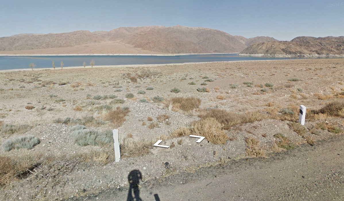
Like Toktogul, it is a reservoir that is not quite full (you can see a white border around the lake). On the road, you will find black and white concrete bollards. Check the rearview mirror meta if you're not sure wether it is Toktogul or Orto Tokoy.
Sary Chelek
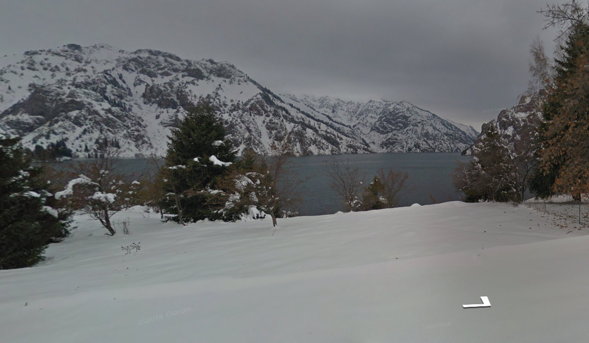
The lake is only visible at the end of the road, the place is covered with snow.
Ozerko
The end of Grigorivka valley, that ou can recognize thanks to the pine trees.
Double carriageways
If you're on a double carriageway, you're either in Bishkek or in one of the following roads :
The training map : Kyrgyzstan dual carriageways.
As usual, make sure to check the rearview mirror.
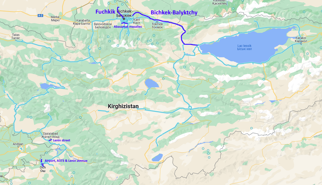
The Bishkek-Balyktchy highway
It's the only real highway of Kyrgyzstan. Check the orientation of the road and the river to find where you are on this road.
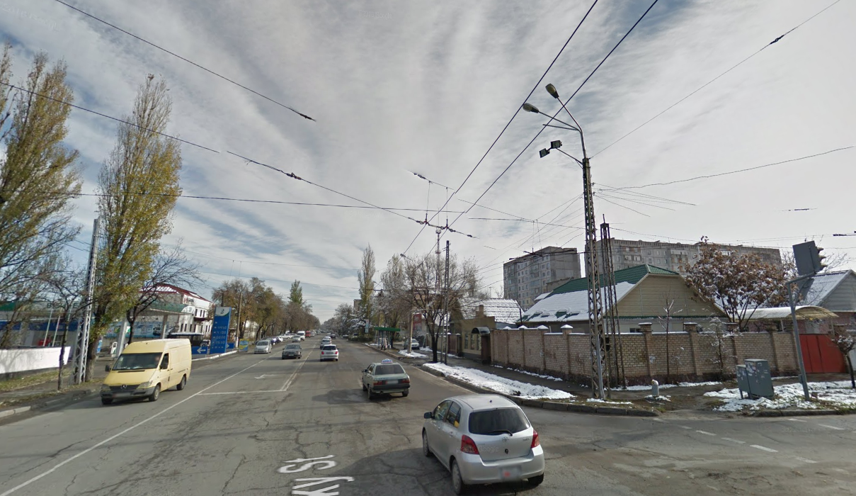
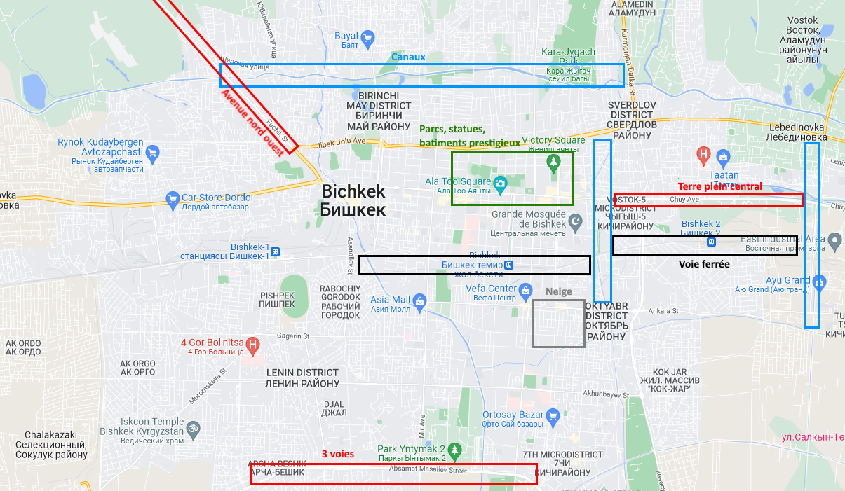
The avenues exiting Bishkek
Fuchkik street (road to the airport) and Kurmanjan Datka street (road to Kazakhstan) have a unique orientation, the Abasamat Masaliev avenue has three traffic lanes.
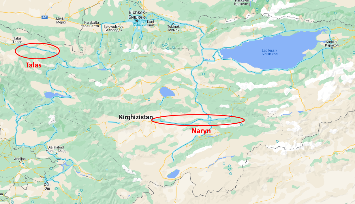
Naryn & Talas
I grouped Naryn and Talas together because they're both east-west valleys with the same dry landscape.
The training map : Kyrgyzstan Naryn and Talas.
Differences
Talas valley ahs an asphalt road, with lines painted on the ground and some road signs, while the road in Naryn valley is very basic.
In the Naryn valley, the google car goes away from Naryn, this is a way to know on which side (east or west) you're on.
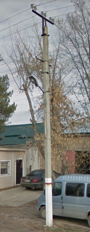
Talas
Talas has unique electric poles with white and red paint :
Other landscapes
All other kandscapes are grouped into one training map : Kyrgyzstan other landscapes.
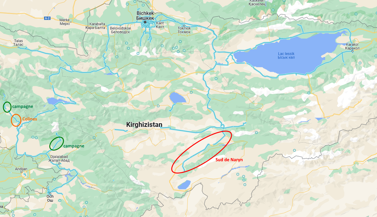
South of Naryn
South of Naryn, there's a major road going south-west with big mountains in th south. This road then turns into the mountains and ends at Tash-Rabat caravanserai.
The hill road
it's the only road going through inhabited hills.
the country roads
Both roads leading to Arslanbob and Sary-Chelek are country roads goign through small villages, check the rearvie mirror to know which one you're on.
Bishkek
Bishkek is a huge city, some landmarks can help you find your location :
The training map : Bishkek landmarks.